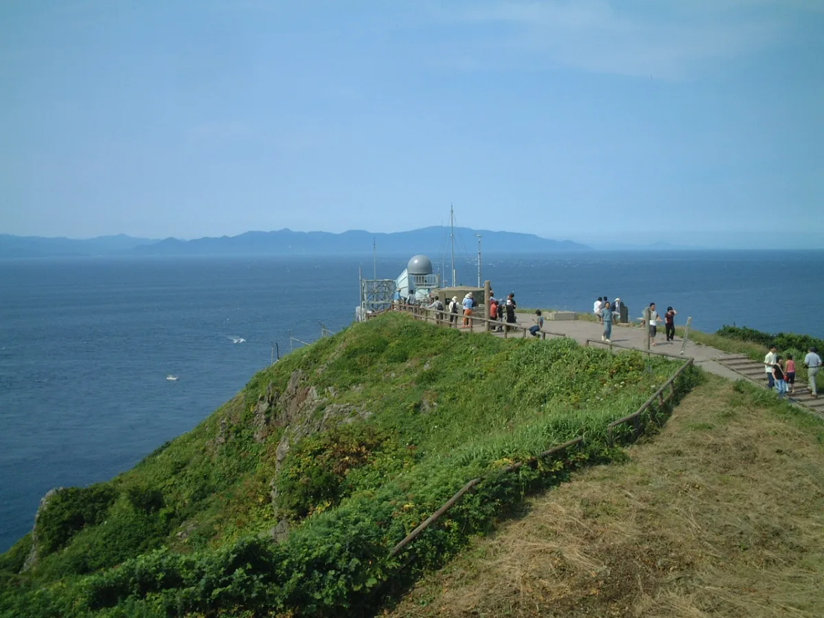
Cape Tappi
龍飛崎
A windswept cape at the tip of the Tsugaru Peninsula, the far north of Honshu. Past its white lighthouse, on clear days, Hokkaido appears across the strait.
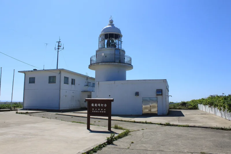
The "cape of wind", with sea on three sides
Cape Tappi (Tappizaki, also written with a different first character) is the northernmost point of the Tsugaru Peninsula in Aomori Prefecture. It is surrounded by sea on three sides: the Sea of Japan to the west, the Tsugaru Strait to the north and Mutsu Bay to the east. The wind off the sea is so strong that it is also called the "cape of wind".
On top of the cape stands the round white Tappizaki Lighthouse, chosen as one of Japan's 50 Best Lighthouses, keeping watch over the ships that come and go through the Tsugaru Strait. On a clear day you can see Hokkaido's Matsumae Peninsula and Mount Hakodate across the strait.
The staircase highway and the song monument
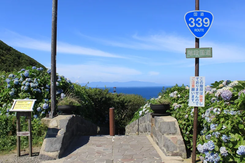
Cape Tappi's famous oddity is the Staircase National Highway. The stretch of National Route 339 from Tappi fishing port below the cape up to the lighthouse is a flight of 362 steps, 388.2 metres long. It is known as a national highway that cars cannot use, and it is the only staircase national highway in Japan. It is closed in winter.
Near the lighthouse is a monument to "Tsugaru Kaikyo Fuyugeshiki" (Tsugaru Strait Winter Scene), a 1977 hit by the singer Ishikawa Sayuri whose lyrics mention Cape Tappi. Press the button on the monument and the song plays from the second verse, starting with the line "Look, that is Cape Tappi, the northern edge".
Dotted around are other monuments too: one carved with a passage from the writer Dazai Osamu's book Tsugaru, a monument carved with a short poem by Kawakami Santaro, and one to Yoshida Shoin, a thinker of the final years of the Edo period.
Learning about the Seikan Tunnel under the sea
At Michi-no-Eki Minmaya (a roadside rest station) near the cape is the Seikan Tunnel Museum. With films and models, it shows how the Seikan Tunnel, which links Honshu and Hokkaido under the seabed, was built, from planning to completion.
Ride the Mogura-go ("mole") cable car down through a shaft used during construction to an experience tunnel 140 metres below sea level. The museum closes in winter (in fiscal 2025, from 4 November to 17 April the following year).
Getting there
By car it is about 90 minutes from the Aomori interchange on the Tohoku Expressway.
By rail, the Kanita-Minmaya section of the JR Tsugaru Line has been suspended since heavy rain damaged it in August 2022, and it is due to be abolished on 1 April 2027. For now, Wantaku, a shared taxi run by JR East, links Kanita Station with the Tappizaki Lighthouse, and there is also a town-run bus. If you are going by public transport, check the latest timetables and how to book before you set off.
Tips
- It is windy enough to be called the "cape of wind". Bring a jacket, even in summer.
- The Staircase National Highway is closed in winter. If you want to walk it, come in the snow-free season.
- The Seikan Tunnel Museum closes for the winter, so once you know when you are going, check its opening period.
Sources
- 龍飛崎|スポット・体験|【公式】青森県観光情報サイト Amazing AOMORI
- 観光スポット 三厩地区 - 外ヶ浜町
- 青函トンネル記念館|交通の博物館ガイド(交通文化振興財団)
- JR津軽線、一部区間廃止でどう変わる? - マイナビニュース
Updated 30 September 2026. Opening hours and prices change, so check the official site before you go.


.jpg)
