Why Don't Most Streets in Japan Have Names?
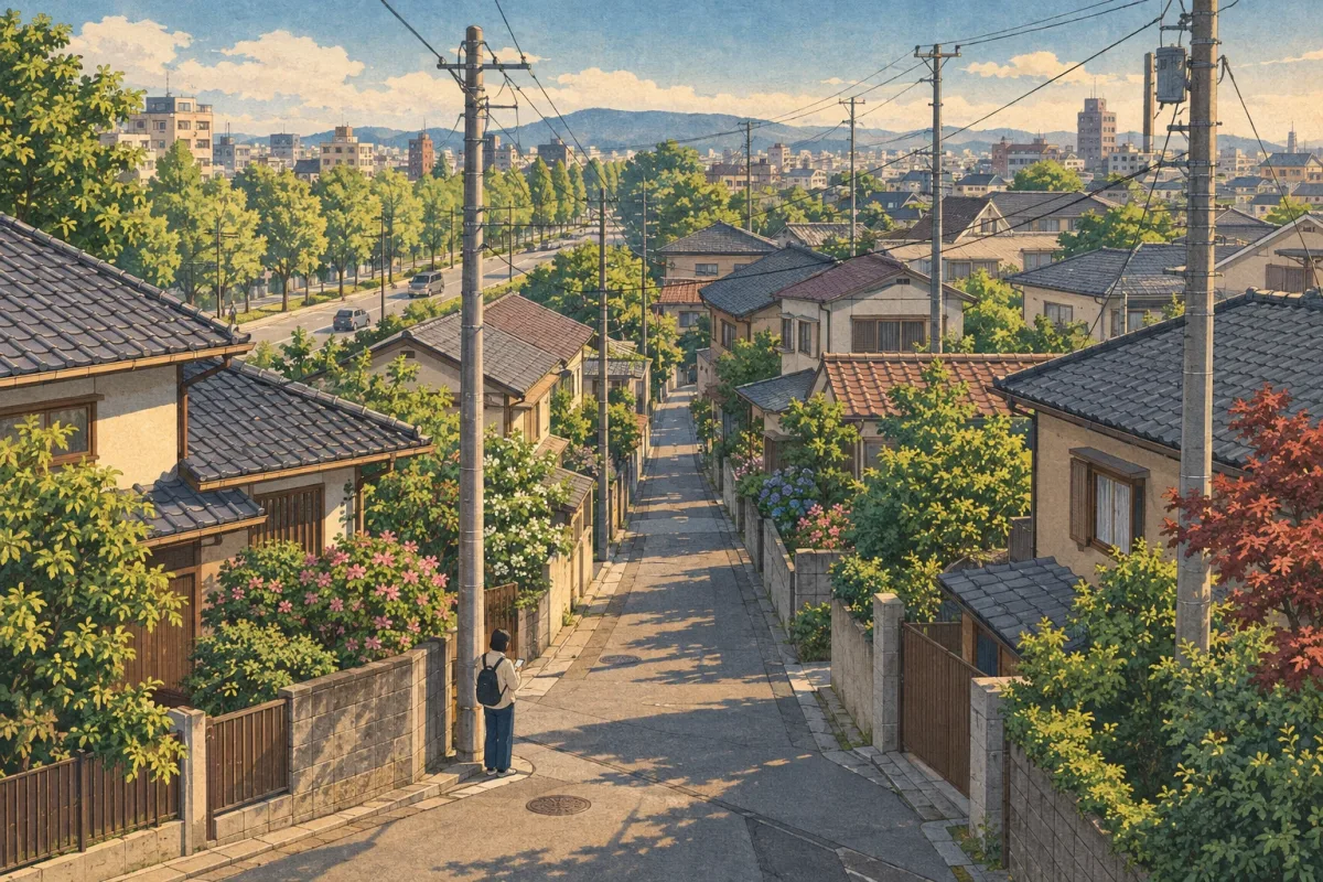
Japanese addresses number blocks, not streets. Roads are not the stars of an address; they are just the lines between blocks.
The short answer
In most of Japan, an address is not "street name + house number" but "district name + block number + building number". Roads are not part of the address; they are treated as the lines that separate one block from another, so there was never any real need to name small streets.
That does not mean streets have no names at all. Major roads often have nicknames chosen by the local government, and some places, such as Kyoto and Sapporo, have distinctive addresses based on streets or a grid.
It started as land numbers
Japanese addresses began with the "chiban" (lot number). A chiban is a number given to each individual plot of land for land registration (the official record of who owns it and so on); it was never designed to help people walk down a street and find a house.
As a result, district boundaries often did not match the actual roads, and the numbers were not laid out in any regular order, making it very hard to find a place from its address. As cities grew, this became a real nuisance for delivering post and for visiting people.
So in 1962 the Act on Indication of Residential Addresses was passed, introducing "jūkyo hyōji" (residential address indication) as a new set of rules to show where buildings are in a way that is easier to understand. Chiban are still used for land registration today, while jūkyo hyōji is used only for the addresses of buildings. In areas where jūkyo hyōji has not yet been introduced, the chiban is still used as the address.
How to read a modern address
There are two systems of jūkyo hyōji, the block system (gaiku hōshiki) and the road system (dōro hōshiki), but the block system is the standard across the country. An area enclosed by roads, railway lines, rivers and so on is called a "gaiku" (block), and each block is given a number.
Next, base numbers are assigned clockwise around the block at regular intervals (about 10 to 15 metres), and a building's number is decided by which of these numbered points its front door faces. Setagaya Ward in Tokyo, for example, explains that it starts from one corner of the block and assigns a number about every 15 metres. How the starting point is chosen varies between local governments.
So "2-chōme 3-ban 4-gō, XX-machi" means the building whose front door is at position 4 of block 3, in the 2-chōme area of the district called XX-machi. In English, addresses are often written with hyphens, like "2-3-4".
The road system, by contrast, gives addresses using a road name and building number, as in Europe and North America. It is very rare in Japan and is used only in parts of Higashine in Yamagata Prefecture and Urakawa in Hokkaido.
Kyoto and Sapporo are the exceptions
In central Kyoto, street names go straight into the address. For example, Doshisha Women's College gives its own address as "Imadegawa-dori Teramachi Nishi-iru Genbu-cho, Kamigyo-ku, Kyoto", meaning "west of the crossing of Imadegawa-dori and Teramachi-dori". Going north is "agaru" (up), going south is "sagaru" (down), and east and west are "higashi-iru" and "nishi-iru" (go in to the east or west). The way people gave directions in this old capital, with its streets laid out like a go board, has survived as the address itself.
Kyoto City has no districts where jūkyo hyōji has been introduced, which shows how deeply rooted street-name addresses are there. One explanation often given for why going north is "going up" is that the city rises gently from south to north. According to a column by Doshisha Women's College, the difference in height between To-ji temple near Kyoto Station (about 23 metres above sea level) and Kitaoji Horikawa to the north (about 77 metres) is about 54 metres, almost the same as the height of To-ji's five-storey pagoda (about 55 metres).
Sapporo uses a grid system called "jō-chōme", where a location is given by how many streets north and west it is from the reference streets, as in "Kita 8-jō Nishi 5-chōme" (North 8, West 5). Both cities' methods work only because their streets and blocks are laid out in straight, orderly lines. Sapporo also does not number its blocks; the grid itself does the job of the address.
Some streets do have names
Even if they are not used in addresses, major roads are given nicknames called "tsūshō dōromei" (popular road names). Tokyo gave popular names to its main roads in 1962-63, 1984 and 2014; examples include Aoyama-dori, Yamate-dori and Kanpachi-dori (Ring Road No. 8). The aim is said to be to make it easier for residents and tourists to get around, and to help evacuation and emergency transport run smoothly in a disaster.
Popular names can change over time. A new road in Toranomon, Tokyo, had long been called "MacArthur Road" after a post-war plan, but in 2013 it was given the popular name "Shintora-dori".
Wards and cities sometimes give roads their own nicknames too. Taito Ward in Tokyo started a road-nickname scheme in fiscal 1988, keeping names long loved by locals, such as Kaminarimon-dori in Asakusa, as official nicknames. In 2009 it added a scheme for even narrower lanes, and as of February 2026 it has approved 20 road nicknames and 57 nicknames for narrow lanes. These names are used on direction signs and in conversation, however, and generally do not appear in postal addresses.
What confuses foreigners, and how not to get lost
What often surprises people is that the numbers do not run in order along the street. Because they are assigned block by block, the other side of the road is a completely different block, and even next-door buildings can have numbers that jump a long way. Buildings whose front doors are at the same point get the same number, so for blocks of flats you may need to include the building name and flat number, or post may not arrive.
In practice, the most reliable way is to type the whole address into a map app. In towns, number plates are often fixed at building entrances and elsewhere, so once you are close you can use them to find your way. Even Japanese people normally follow a map app when going somewhere new, so do not worry if you get lost.
Being able to give your address properly also helps in an emergency. One of the original aims of jūkyo hyōji was not only postal delivery but also helping ambulances and fire engines reach the scene quickly. Once you start living in Japan, it is reassuring to note down your home address in Japanese, right down to the "X-chōme X-ban X-gō", in your phone's notes or somewhere similar, so you can say it.
Tips
- Enter the address into your map app in full, right down to the chōme, ban and gō. Do not forget the building name and room number.
- Numbers like "2-3-4" are short for "2-chōme 3-ban 4-gō". They are block numbers, not numbers along a road.
- Near your destination, look for the address number plates at building entrances; they make it much easier to find.
- In Kyoto addresses, "agaru" means north and "sagaru" means south, while "nishi-iru" and "higashi-iru" mean going in west or east from the crossing.
- When asking for directions, landmarks such as stations, big crossings and prominent buildings will get you further than street names.