Mt. Kanpu Rotating Observatory
寒風山回転展望台
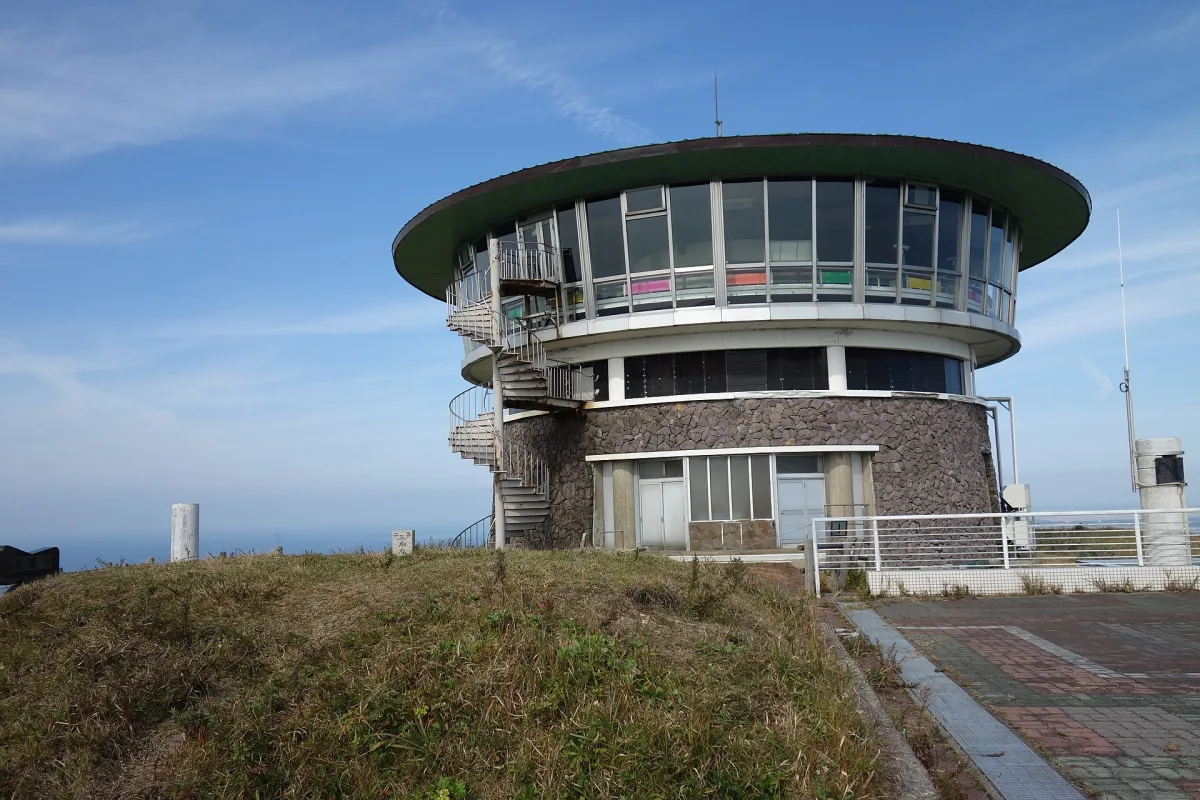
A rotating observatory atop grassy Mt. Kanpu that turns once every 13 minutes, showing the Sea of Japan coast, Mount Chokai and Ogata village as you sit.
The summit of a grass-covered volcano
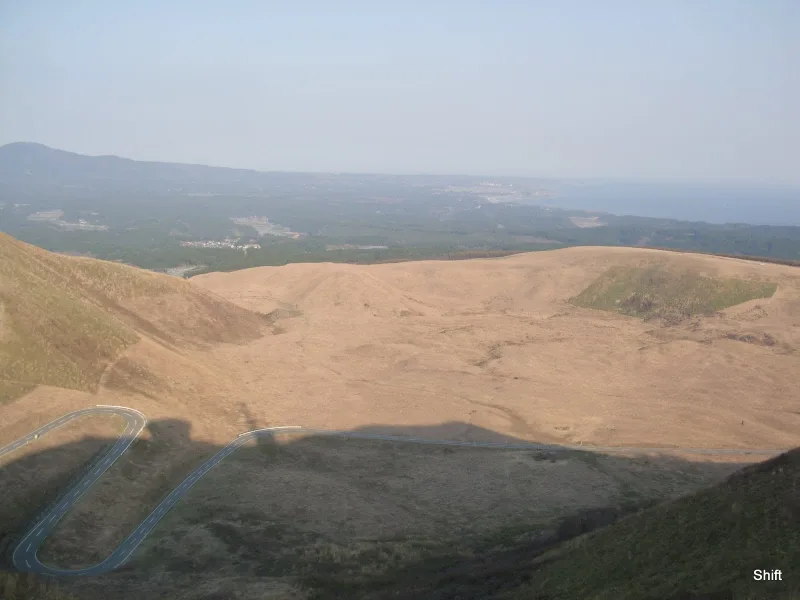
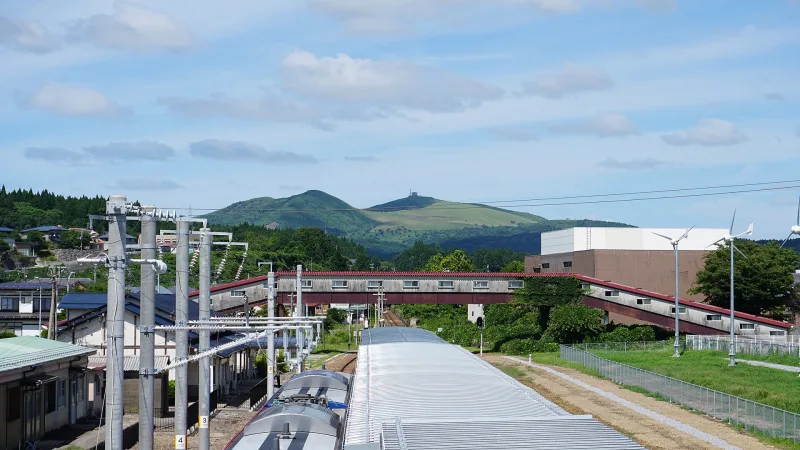
Mount Kanpu (Kanpuzan) is a volcano about 355m high in Oga, Akita Prefecture. It first became active more than 30,000 years ago, and layer upon layer of lava built it into its present shape. Most of the mountain is covered in lawn-like grass and meadow with almost no trees, so nothing blocks the view. This grassland landscape is maintained by regular yamayaki (burning off dead grass to keep the grassland open) and mowing.
The andesite that forms the mountain is also called Oga stone (Oga-ishi) and has been used for things such as riverbank and sea walls and garden stones. The Mount Kanpu area is part of Oga Quasi-National Park and is also one of the highlights of the Oga Peninsula-Ogata Geopark (an area recognised as a place to learn how the land was formed).
An observation room that turns 360 degrees in 13 minutes
The rotating observatory opened in 1964 and took on its present form in a 1988 renovation. The floor of the observation room on the fourth floor turns slowly, going all the way round in about 13 minutes. Just by sitting there, you watch the view gradually change.
According to the official website, to the south you can see the coastline running towards Akita City, with Mount Chokai beyond it. To the west are Honzan, the highest peak on the Oga Peninsula, Shinzan, said to be where Namahage (the masked visiting deities of Oga's New Year's Eve) began, and Cape Nyudo. To the north lie Noshiro Port and the Shirakami Mountains, a World Natural Heritage site. To the east spreads the village of Ogata, created by reclaiming Hachirogata, once the second-largest lake in Japan. Reclamation means draining a lake or sea to make dry land, and Ogata is the largest man-made land in the country. These days you can also see the large wind turbines lining the coast and offshore wind turbines.
The building has a restaurant and a souvenir shop, and on the third floor there is an exhibition room introducing the nature and history of the Oga Peninsula.
Walk around the observatory too
Mount Kanpu keeps its volcanic landforms well, including an old crater, Itaba no Dai where you can see the traces of lava flows, and Oni no Kakurezato (the Demons' Hideaway), a jumble of huge piled-up rocks. The grassy slopes are also well known as a paragliding spot.
According to Oga Navi, the tourism website officially recognised by Oga City, you can see clusters of golden-rayed lilies (yamayuri) in bloom from around mid to late July. In the evening you can also watch the towns and the sea glow in the setting sun.
Opening season and getting there
The rotating observatory closes for the winter and is usually open from around mid-March to around early December. Opening and closing dates may change because of snow and other factors, so check the official website.
There is no local bus to Mount Kanpu. It is about 10 minutes by car from Wakimoto Station on the JR Oga Line. If you don't have a car, you can use the Kanpuzan Liner, a shared sightseeing taxi linking Oga Station and Mount Kanpu. If you are driving, the Kanpuzan Panorama Line road takes you up to the summit.
Tips
- The clearer the day, the further you can see. If you want to see as far as Mount Chokai or the Shirakami Mountains, pick a day with good weather.
- It closes in winter (from around mid-December to around early March). If you are going in late autumn, check the last day of the season on the official website.
- The Namahage Museum is in the same city of Oga, so it is easy to plan a day touring the Oga Peninsula using the Kanpuzan Liner or a hire car.
Sources
- 寒風山回転展望台公式ホームページ
- 寒風山回転展望台・営業時間と料金(公式)
- 寒風山ジオサイト|男鹿半島・大潟ジオパーク公式サイト
- 寒風山回転展望台|アキタファン(秋田県公式観光サイト)
- 寒風山|男鹿なび
- 寒風山 (秋田県) - Wikipedia
Updated 29 September 2026. Opening hours and prices change, so check the official site before you go.