Nagatoro Iwadatami
長瀞岩畳
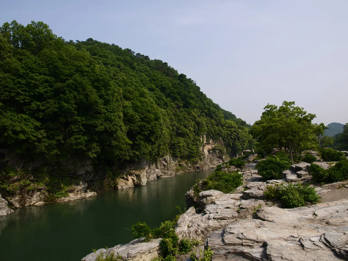
Flat rock slabs spread like tatami mats along the Arakawa River in Nagatoro, Saitama, a short walk from the station, with river boats drifting past.
Rock laid out like tatami mats
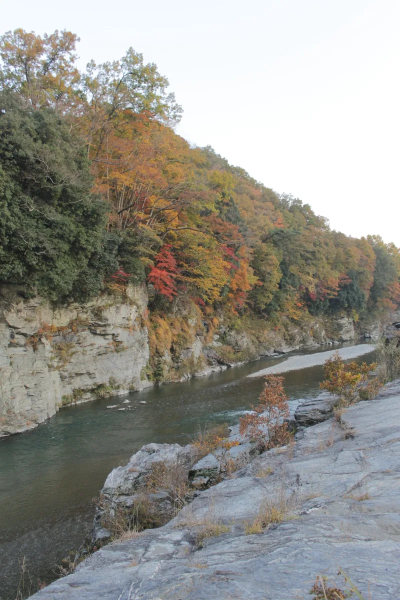
Nagatoro Iwadatami is a rocky riverbank on the Arakawa River in the town of Nagatoro, Chichibu District, Saitama Prefecture. The name means roughly "rock tatami": uplifted crystalline schist lies flat here, quite literally like tatami, the woven straw mats of a traditional Japanese room, laid edge to edge. It is the heart of any visit to Nagatoro.
The rocks stretch about 80m wide and about 600m long, an area equal to some 20,000 tatami mats. Cracks known as joints run through the rock almost at right angles, east to west and north to south, and they are what give it that squared-off, mat-like look.
"The birthplace of Japanese geology"
The rock began as layers laid down on the sea floor, which were pushed down to a depth of about 20 to 30km underground and transformed by enormous pressure. The cracks formed later, as the rock was forced back up towards the surface.
Because the Nagatoro area has been studied since the early Meiji era (the late nineteenth century), it is known as "the birthplace of Japanese geology", and in 1924 it was designated a national Place of Scenic Beauty and Natural Monument. On the rocks you can also see potholes (oketsu), round hollows carved out by stones spinning in the river's current; the largest are about 2m across.
The Chichibu Red Cliffs and the river boats
In front of the rocks the Arakawa slows down and forms a deep, still pool of the kind called a toro. That is where the name Nagatoro comes from. On the opposite bank rise the sheer rock walls known as the Chichibu Sekiheki (the "Chichibu Red Cliffs"), and there is also the Myojin Falls.
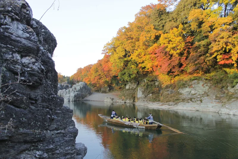
Right beside the rocks, the Nagatoro Line Kudari boats set off: wooden boats steered by boatmen who guide you down the gorge. Spring brings cherry blossoms and autumn brings red leaves, so the view from the water changes with the seasons. Boats may be cancelled when the river is running high or low, and there is a break in service during winter.
Getting there
It is about a 5-minute walk from Nagatoro Station on the Chichibu Railway.
The Saitama Museum of Natural History nearby (about a 10-minute walk) hands out a free map for exploring the rocks. Drop in before you go and you will understand much better what you are looking at.
Tips
- The rock surface is uneven and gets slippery when wet, so wear trainers or other comfortable shoes.
- As well as the free map for exploring the rocks, the Saitama Museum of Natural History displays fossils, including metasequoia.
- The river boats run or stop depending on the weather and the water level. If you want to ride, check the day's operating status.
Sources
- 名勝及び天然記念物「長瀞」 | 長瀞町役場
- 名所 | 長瀞町観光協会公式サイト
- 長瀞ラインくだり | 長瀞町観光協会公式サイト
- 野外展示と長瀞「岩畳」 | 埼玉県立自然の博物館
- 長瀞渓谷(長瀞岩畳)・船下り | ちょこたび埼玉
Updated 29 September 2026. Opening hours and prices change, so check the official site before you go.

.jpg)
.jpg)